Felling Maps

For all the genealogists and history fans I've photographed the OS map of 1894 and for parts this can be compared with the first edition map of the 1850's
Left click to enlarge

This is the bottom end of Low Felling showing St Patrick's RC School, Northern Machine Tool Works, Felling House and Farm, Heworth Lodge

Left click to enlarge
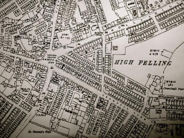
Coming up towards the Car Lines there's Christ Church and the Vicarage, Church Place, Lamas Street, Summer Street, Carlisle Street, Dempster Ville, William Street, Mulberry Street, The School, Brandling Terrace
This the same area in the 1850's. Note Christ Church and Vicarage and Church Place and Lamas Street have not been built. Carlisle Street continues on as Brewery Lane
Here in 1894 we have Garden House, Felling Colliery (John Pit) and across the car lines Back Elliot Street
1894 still, we have Pensher Street, Elliot Road, Cross Row, Sunderland Road, Ford House and Rectory
Here we have St James Road, Elswick Street, Regent Street, North Tyne Street, Frank Street, Cooper Street, Hylton Street, Beech Street
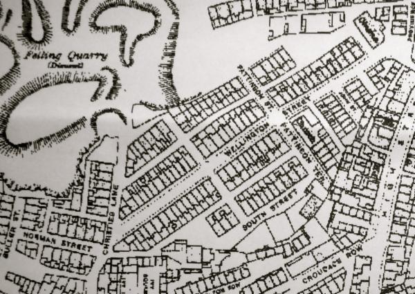
Here we have Dorothy Street, Quarry Row, Wellington Street, South Street, John Street, Ivy Square, Charlton Row, Croudace Row, Chapel Square, Park Row, Neville Street, Brown Place, Catherine Terrace, Christie's Lane
Booth Street, Havelock Street, Ridley Street, Cross Street, Garden Terrace, Wallis Street, Chapel Street, Stephenson Terrace, Belgrave Terrace
Park Road, Parkinson Street
Park Road,
Causeway Cottages, Johnson's Buildings,
1916 Map