Derivation of the Place Name "Felling"
How did The Felling get its name?
The quick answer: the same way as The Low Fell and The High Fell got their names. All three are part of The Gateshead Fell.
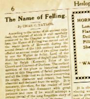
This does not alter my view. [Since forming this view I have recently come across an article written by local historian Chas C. Taylor and published in a Heslop's Advertiser in 1939. Here's a snippet
Fell is a Norse word for a high and, at its height, barren/moor-like/tree-less landscape and it describes the topography of the area south and east of Gateshead lying between the river Tyne to the north and east and one of its tributaries, the Team, to the south and west.
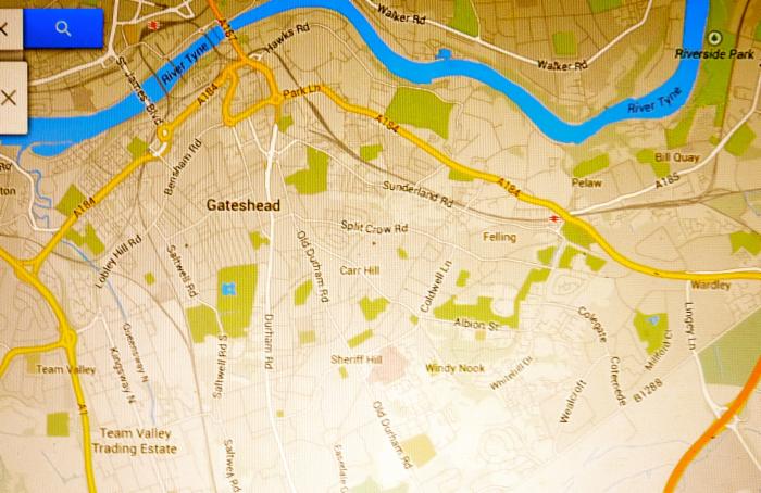
From the Team Valley, once wooded, the land rises steeply through the Low Fell (see Durham Road on map) to the non wooded moor-like High Fell (see Old Durham Road, Sheriff Hill on map), and, at its pinnacle, at 520 feet, the Windy Nook and Carr's Hill (see map) after which it descends (see Coldwell Lane on map) to the Felling, becoming increasingly wooded, beyond the Park Lane (ie Hunting Park Lane) A184 (see map) til it reaches the River Tyne. In the Felling area it was called the Hayningwood and haining means it was preserved/enclosed by eg hedge, but see ** below
Elevations
team valley 29 feet
durham road, low fell 288 feet
queen elizabeth hospital 518 feet
windy nook 449 feet
coldwell lane 367 feet
Felling Square 242 feet
Christchurch 104 feet
River Tyne (Elephant and Castle) 68 feet
Try it for yourself
Let's consider the North/South plane. The original Durham Road travelling from South to North passed up the Newcastle Bank, then the Long Bank (passing by Eighton Banks), continued to Beacon Lough and started to descend to Gateshead Town Centre by way of Sheriff Hill / Sod House Bank, ultimately reaching the Tyne by way of Bottle Bank.
So this huge topographical lump has as names hills, beacon (beacon means a hill, as well as a signal) and banks on its North-South plane, on its south west side the rise is known as Low Fell and High Fell and on the north east side, the fall down to the Tyne is called Fell-ing, at one time always, and sometimes still, called High Felling and Low Felling. The exact mirror image, but for the -ing There had to be a distinction...both sides of The Fell couldn't have the same names and the "ing", a place-name ending used all over the Country was an obvious distinction (“Fell-ing” meaning “the dwellers on the Fell)***
It is consistent and makes perfect sense.
The perceived wisdom ignores that the other 3 planes recognise that it is a fell (moor) or hill and claims its name derives from the felling of trees. It never even discusses, nor discounts as a reason for the name, the fact that Felling lies on the north east descent of a fell.
Undoubtedly, there was, indeed, a large blanket of trees hugging the south shore of the Tyne from Gateshead to Bill Quay, the Bishop of Durham having his hunting park in Gateshead and the Dean, next in the hierarchy, having his hunting park in Felling. However, huge areas of Britain were once covered in trees and are not now because of the en masse felling of trees. Fellynge, or other spelling variations, already existed to describe that place, full of trees at its Northern lower end ..not nameless, until the trees were felled. That would beggar belief as does this
"..a place where timber has been felled-a reasonable assumption as much of the county"...indeed much of the country... "was at one time thickly forested". If place names derive from the chopping down of trees why aren’t there many more towns called “Felling” ? There are no other Fellings!
It's obvious. Places with trees have names and the name doesn't change to reflect that trees have been chopped down to build farms or factories. That clip comes from notes by historian Joan Hewitt but feallan (click the link) means to ‘fall’ (‘i-falle’), fall headlong, fail, decay, die,
In Anglo Saxon ' feallan' does not relate to the act of felling trees.
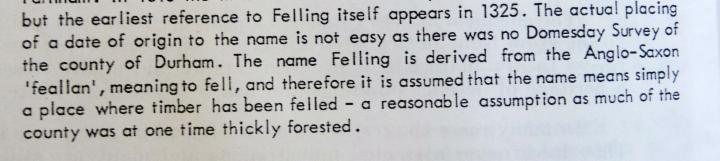
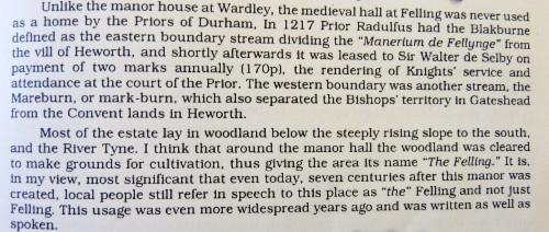
(As an aside, note name first appearing in 1325 but below she says in 1217 there is reference to "Manerium de Fellynge")
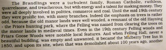
Here, Mrs Hewitt makes the 'tree felling" point again
In this next clip she is implying that because people add the definite article The Felling this adds weight to the notion that the name comes from the felling of trees
Not so, when people said The Felling on the north east side of the fell those on the south west side said The High Fell and The Low Fell
I’ve used the definite article above when talking about Low Fell and High Fell for I’ve seen many references to bits of the Gateshead Fell being called, in times past, for example The Low Fell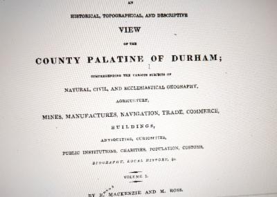
In this book, for example, there's these![]()

Below at * I've provided a link to a page in the book where you'll see the last two lines read “There is another nursery and seedsman in Gateshead, on a smaller scale, and there are several market gardeners in Bensham and on the Low Fell
The new Durham Road to this day is called, by the locals, The Fell . As said earlier the ending of “ing”,
used in many towns and cities throughout Britain primarily means “the people of.. / the dwellers at..” *** and it is my absolute conviction that this is the reason that this part of the
Gateshead Fell was, and still is, called Felling.
So that is my theory. I'm sure I'm not alone..others will have expressed a similar view, orally, but I can find nothing specific in writing. ( I now have..see here ..it being said in the 1930s) Remember, you read it here first, online..published today on 1st July 2014...
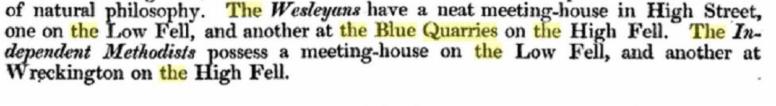
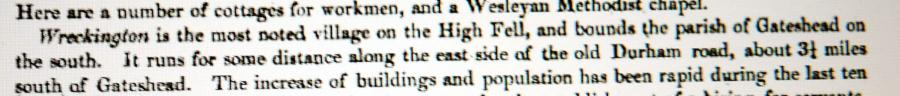
*one example, of many I've seen, of the use of the Low Fell may be found here
An Historical, Topographical and Descriptive View of the County Palatine of Durham
comprehending the various subjects of Natural, Civil and Ecclesiastical Geography, Agriculture, Manufactures, Navigation, Trade, Commerce, Buildings, Antiquities, Curiosities, Public Institutions, Charities, Population, Customs, Biography, Local History, Volume 1 by E. MacKenzie and M. Ross...published 1834
**“haining” means to save or preserve. Farmers still “hain” a field of grass to make hay. A “haining wood” is a copse where the trees were safe from felling. ( ironic?)
It is a place-name found in Northumberland and Scotland
*** ing is more often applied to "the people of.. a tribe leader's name, particularly in the South of England eg Reading...the people (followers) of Reada but it is also used as " the dwellers at...a landscape feature eg Tring... Tre', meaning 'Tree'